Difference between revisions of "Ifru"
m |
m |
||
| Line 29: | Line 29: | ||
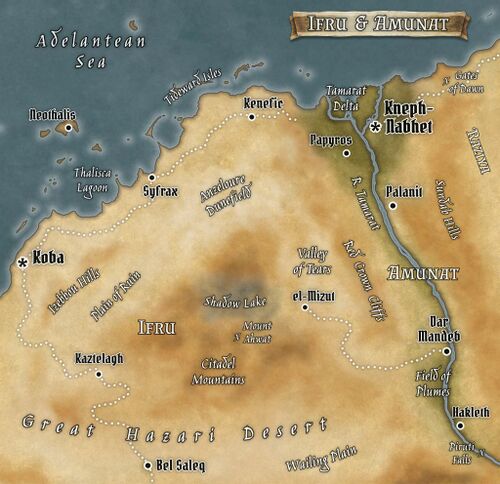
[[File:Ifru-Amunat small.jpg|thumb|500px|Ifru Province and its eastern neighbor Amunat, Sirdabi Caliphate]] | [[File:Ifru-Amunat small.jpg|thumb|500px|Ifru Province and its eastern neighbor Amunat, Sirdabi Caliphate]] | ||
==People== | |||
==Economy== | |||
==Religion== | |||
==Cities & Towns== | |||
==Points of Interest== | |||
[[Category:Geography]] | [[Category:Geography]] | ||
[[Category:Lore]] | [[Category:Lore]] | ||
Revision as of 16:04, 3 March 2023
| Allegiance | Sirdabi Caliphate |
| Capital | Koba |
| Demonym | Ifari |
| Official Language | Sirdabi |
| Official Religion | Azadi |
| Currency | fals/dirham/nour |
| Native Heritages | Tessouare, Sirdabi, Razmani |
Often considered the backwater of the Sirdabi Caliphate Ifru is nonetheless centrally located among the caliphate's Idiri provinces, lying along the Adelantean coast east of Tessere and west of Amunat. With a relatively small population, unforgiving terrain, and poor harborage, the province still plays a key role in trans-Hazari trade and its towns are vital waystations along one of the most well-traveled caravan routes of the continent. Ifru is part of the Tessouare heartland and was once a great center of civilization and commerce, from ancient times through the days of the Ruveran Empire. Numerous ruins lie scattered across the province, some of Ruvan origin, some dating back to the Tessouare city-states, all of them now desolate in the middle of half-forgotten valleys and fields of windblown dunes.
